

Any App For Trip Planning
Topic 18165 | Page 1

Trucker path will show you alot.. including Wal-Mart,major and minor truckstops, weigh stations. . All kinds of stuff...

Trucker Path shows the truck stops, weigh stations, rest areas and stuff.
The is also a simple A to B route finder that can highlight the POIs on the route, but as a GPS, I wouldn't trust that route to go to the corner store.
I found that the Trucker Path map screen does not go dark. I like to drive with it open so I can see "The Big Picture" map.
Other than paying attention to your hours, looking at the route you intend on taking Vs what you get on the Qualcomm and do you have time to stop? Do you need to stop at WALMART for food and what not? Other than that your trip planning really comes with experience. Add hours when pulling heavy through the mountains not minutes. Same with big city's.. add time.
If you pull into a truckstop on Sat. Near the east coast you might not find a spot. What do you do then? Check Trucker path and see what is near. Walmart won't always let you park so check and see if they allow parking for trucks... Walmart is full now what? Check for rest areas and weight stations with parking..
It's not always like that but you do need to be prepared for this kinda thing just in case. . So your not caught with your pants down.
Qualcomm:
Omnitracs (a.k.a. Qualcomm) is a satellite-based messaging system with built-in GPS capabilities built by Qualcomm. It has a small computer screen and keyboard and is tied into the truck’s computer. It allows trucking companies to track where the driver is at, monitor the truck, and send and receive messages with the driver – similar to email.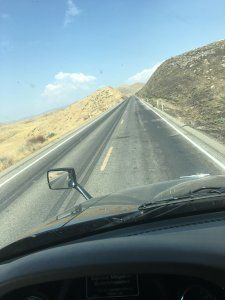
Thank you everyone
New Reply:
New! Check out our help videos for a better understanding of our forum features


Preview:


Why Join Trucking Truth?
- The High Road Training Program
- The High Road Article Series
- The Friendliest Trucker's Forum Ever!
- Email Updates When New Articles Are Posted
Apply For Paid CDL Training Through TruckingTruth
Did you know you can fill out one quick form here on TruckingTruth and apply to several companies at once for paid CDL training? Seriously! The application only takes one minute. You will speak with recruiters today. There is no obligation whatsoever. Learn more and apply here:
 TT On Facebook
Hello anyone know any app for trip planning