Truckers Path New Routing Highly Inaccurate
Topic 25536 | Page 2
Again I don’t use it for routing.
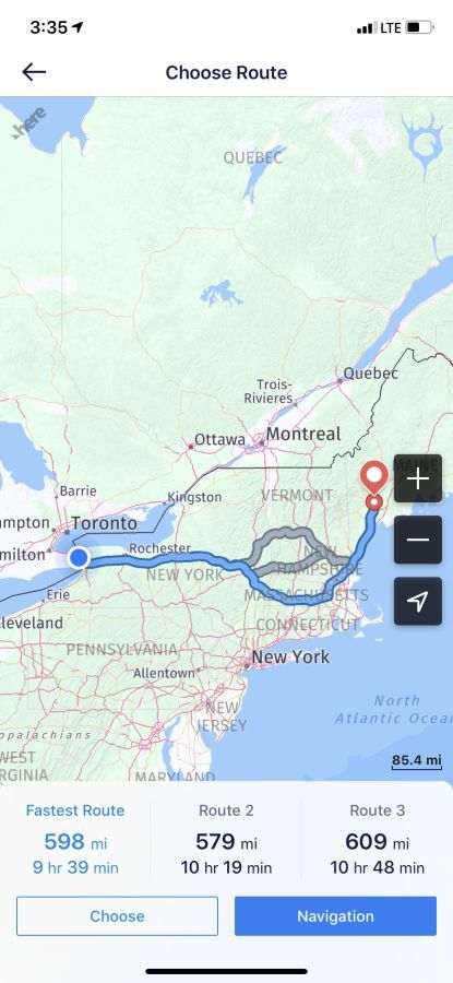
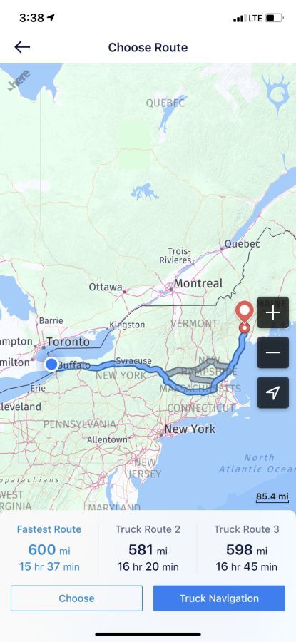
I use it for trip planning just to get a quick mileage/time estimate for my eta. In the past it has been fairly accurate, though I always round up a bit to be safe. But with the new truck routing feature it adds about 50% to the travel time for the same mileage.
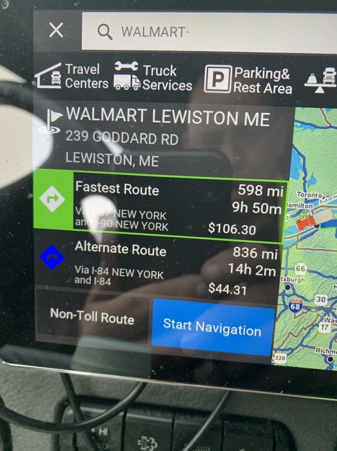
Truckers path (old style) vs Rand McNally


Truckers Path truck routing. Notice the miles and route are the same, but it takes WAY longer.

Most likely cause is it's using a lower average speed in it's calculations.
Most likely cause is it's using a lower average speed in it's calculations.
37 mph? LOL
Most likely cause is it's using a lower average speed in it's calculations.
37 mph? LOL
Maybe a Prime truck?
Most likely cause is it's using a lower average speed in it's calculations.
37 mph? LOL
Well everyone always complains about the traffic in the northeast.....
Yeah I could see that actually happening if you drove during the day out here.
I usually get right at the regular estimate. I run 600 mile days in the NE.
Copilot TRUCK.... There are 3 different versions.(2 trucks and a car) I started using it on the Walmart NE Dedicated, it worked Far better than the Qualcomm.
If you are going to use an app, you should use Copilot Truck. It is definitely worth the monthly or yearly subscription. I use my atlas and copilot, that is it.
I tried CoPilot’s GPS feature. First thing it did was try to route me on a parkway.
Qualcomm:
Omnitracs (a.k.a. Qualcomm) is a satellite-based messaging system with built-in GPS capabilities built by Qualcomm. It has a small computer screen and keyboard and is tied into the truck’s computer. It allows trucking companies to track where the driver is at, monitor the truck, and send and receive messages with the driver – similar to email.New Reply:
New! Check out our help videos for a better understanding of our forum features


Preview:
This topic has the following tags:
Advice For New Truck Drivers Driver Responsibilities Electronic Logbooks GPS Systems


 TT On Facebook
It may just be that I’m missing something, but a few updates ago, trucker path started using “air miles.” I hate having to plug everything into google maps to get the actual miles to a truck stop. Used to be able to just do quick math, 300 miles to a stop=six hours. Now there’s extra steps. Unless I’m missing a setting.